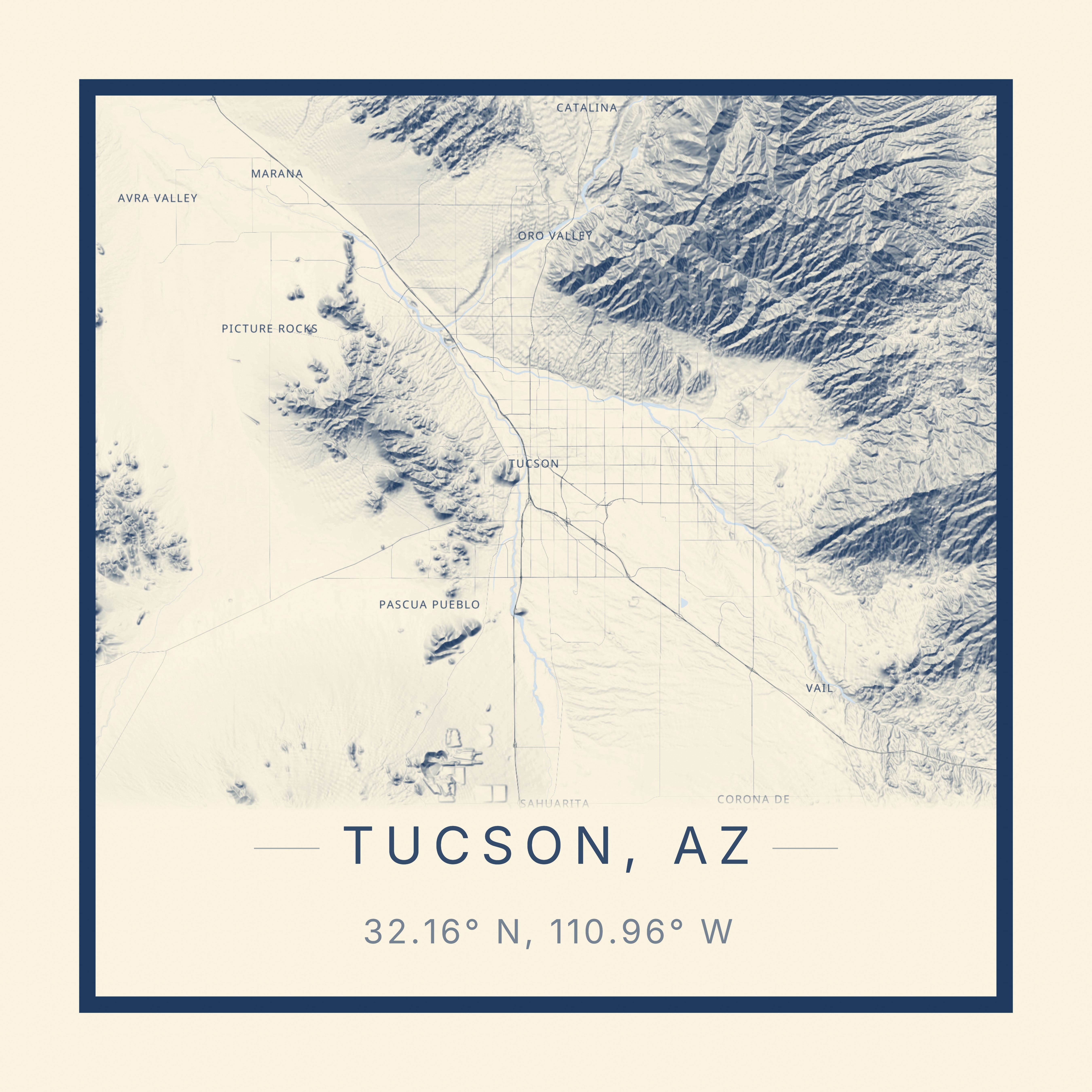
Carto Art is a free, open, professional-grade cartographic design tool that enables users to transform any location on Earth into museum-quality map posters using real geographic data. It is designed for creators, designers, and anyone who wants to produce personalized wall art, allowing users to pick any place, frame it precisely, and apply a wide range of curated artistic styles to generate print-ready artwork. The tool serves as a comprehensive platform for cartographic expression, removing technical barriers and providing a seamless workflow from location selection to final high-resolution export, making sophisticated map design accessible to a broad audience without any cost or account requirements.
Traditional map creation for artistic or decorative purposes often requires expensive software, specialized design skills, and access to complex geographic data, which can be prohibitive for casual users or small creators. Many individuals seek personalized wall art that represents meaningful locations—such as hometowns, travel destinations, or favorite landscapes—but find existing solutions limited, costly, or lacking in aesthetic customization. Carto Art addresses this by offering a free, web-based tool that democratizes professional cartographic design, solving the pain point of inaccessible, high-quality map poster creation and enabling users to produce unique, stylized geographic art with ease.
The first major feature group is the extensive style and customization library, which includes 10 distinct artistic styles and over 80 color palettes. Styles range from Midnight Noir and Vintage to Watercolor, Abstract, and Minimal Line Art, allowing the same geographic location to be transformed completely with a single click. This system enables deep aesthetic control, letting users fine-tune the visual presentation to match personal taste or interior design themes. The availability of such a broad range of pre-curated styles means users can experiment freely without needing design expertise, ensuring each map poster can become a unique piece of art that reflects individual creativity and preference.
The second major feature group centers on professional-grade output and technical quality, including true 3D terrain rendering and high-resolution export capabilities. The tool uses real elevation data to render mountains and landscapes as true 3D terrain, with adjustable vertical exaggeration, sun angle, and mesh quality for detailed control over the topographic appearance. Users can export maps at print-ready resolutions up to 24x36 inches at 300 DPI, which translates to 7,200 by 10,800 pixels, ensuring vector-sharp lines suitable for large-format professional framing. This combination of detailed 3D visualization and high-fidelity output guarantees that the final posters are of museum-quality, meeting the standards of both personal decoration and professional use.
admin
Additional capabilities include granular layer control and interactive editing features, allowing users to toggle individual map elements like streets, water, terrain, buildings, parks, railroads, and raceways independently. Users can adjust line weights from fine to bold and choose from the extensive palette library across all styles, providing precise control over every visual detail. The tool also supports adding custom markers and routes, enabling personalized annotations for special locations or journeys. Furthermore, a community gallery showcases over 100 maps created by more than 2600 creators, allowing users to browse, get inspiration, and even remix existing designs as a starting point for their own projects.
Overall, Carto Art works through a streamlined three-step process: users first search for any location on Earth down to the street level, then customize the map using the style, palette, and layer controls, and finally export the finished design at high resolution. The tool is built as a web application, requiring no software installation or user account, and it leverages real geographic data to ensure accuracy. The technical approach integrates cartographic data processing with a user-friendly interface, making advanced design operations simple through intuitive sliders, toggles, and previews, all while maintaining professional output quality suitable for physical printing.
The benefits for users are significant and measurable, including the ability to create unlimited custom map posters completely free of charge, with no watermarks or subscriptions required. Users gain access to professional-grade design tools that would otherwise be costly, enabling them to produce art for personal gifts, home decor, or commercial projects. The tool saves time and eliminates the learning curve associated with traditional graphic or GIS software, providing immediate, satisfying results. Being trusted by over 2600 creators who have made more than 100 maps demonstrates its reliability and the tangible outcomes of high-quality, personalized artwork that can be printed and displayed.
Concrete use cases include creating a personalized wedding gift map of the couple's honeymoon destination, applying a Vintage style with custom markers for significant spots. An interior designer might use the tool to produce a series of Minimal Line Art maps of client hometowns for a gallery wall in a living room, exporting at 24x36 inches for framing. A travel blogger could generate Atmospheric style maps of adventure locations to sell as prints, utilizing the commercial license available in the Carto Plus plan. An educator might create a Blueprint style technical map of a local watershed for a classroom, toggling terrain and water layers to highlight geographic features.
The target users are creators, designers, travelers, homeowners, and professionals seeking custom map art for personal or commercial use. The tool integrates with standard printing workflows, as exports are ready for any print shop or can be ordered as shipped prints. The tech stack is web-based, accessible from any modern browser. Pricing plans include a free Explorer tier with 5 daily exports for personal use and a Carto Plus tier at $9/month offering unlimited exports, commercial license, 4K video/GIF export, cinematic camera automations, 3D model (STL) export, and GPX file import for advanced users.
In summary, Carto Art provides an unparalleled free platform for turning any geographic location into high-quality, stylized map posters. It combines extensive artistic customization with professional technical capabilities like 3D terrain and print-ready resolution, all within an accessible, no-friction web interface. By removing cost and complexity barriers, it empowers a wide community of users to create meaningful, beautiful cartographic art that celebrates the places that matter most to them, fostering both personal expression and creative sharing.
Carto Art targets creators, designers, travelers, homeowners, educators, and professionals who want to create custom, high-quality map posters for personal or commercial use. This includes individuals seeking personalized wall art of meaningful locations like hometowns or travel destinations, interior designers needing custom decor elements, content creators and bloggers looking for unique visual assets, educators requiring illustrative geographic materials, and small businesses or entrepreneurs wanting to sell map-based products. The tool is designed for users who value aesthetic customization, professional output quality, and an accessible, free-to-start workflow without the complexity of traditional graphic or GIS software.
Updated 2026-02-28